Fort Collins CSU temperature plot
Fort Collins Christman Field temperature plot
Fort Collins CSU weather home page
Fort Collins Christman Field home page
Fort Collins CSU monthly plots
Fort Collins Christman Field monthly plots
MesoWest
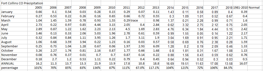
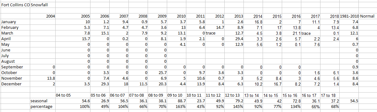
Fort Collins Monthly Climate Data
Fort Collins Snowstorms 2006-2009
Fort Collins Blizzard of 2006
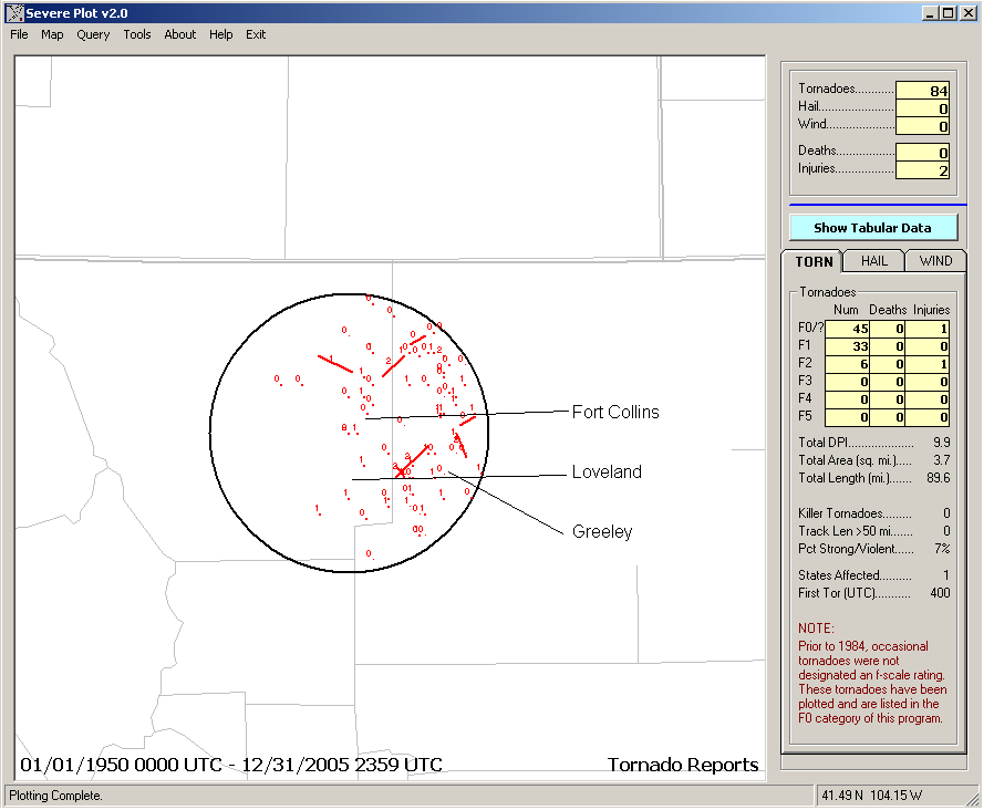
Tornadoes near Fort Collins in past years
All tornado reports 1950-2005
All tornado reports within 25 miles (40km) of Fort Collins 1950-2005
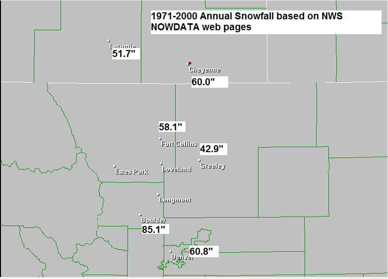
Snow Climatology of Colorado
Northeast Colorado Area Snowfall Climatology
NWS Denver snow page
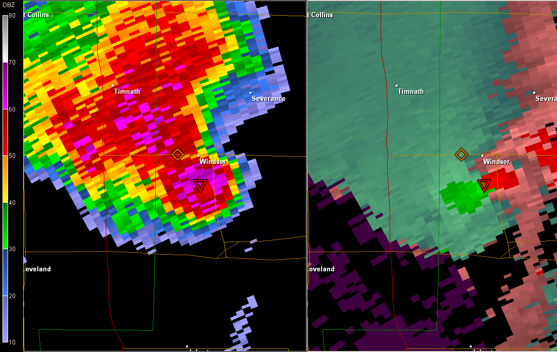
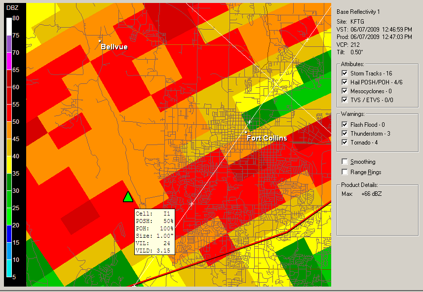
Radar image from Windsor/Greeley area tornado May 22, 2008. Image is from 1753z or 11:53AM MDT.
Radar image is from FTG (Denver) radar. Approximate scale is 17 miles north to south
Case Study Web Page on the Windsor Tornado May 22, 2008 by CIRA/Colorado State
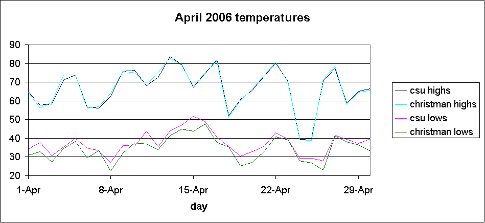
April 2006 temperatures
May 2006 temperatures
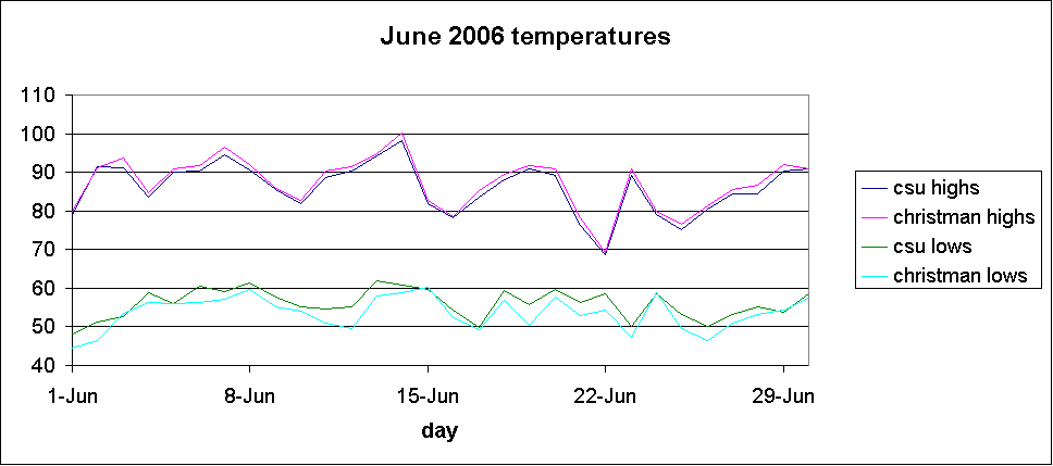
June 2006 temperatures
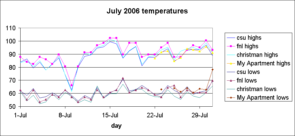
July 2006 temperatures
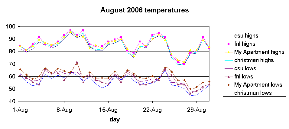
August 2006 temperatures
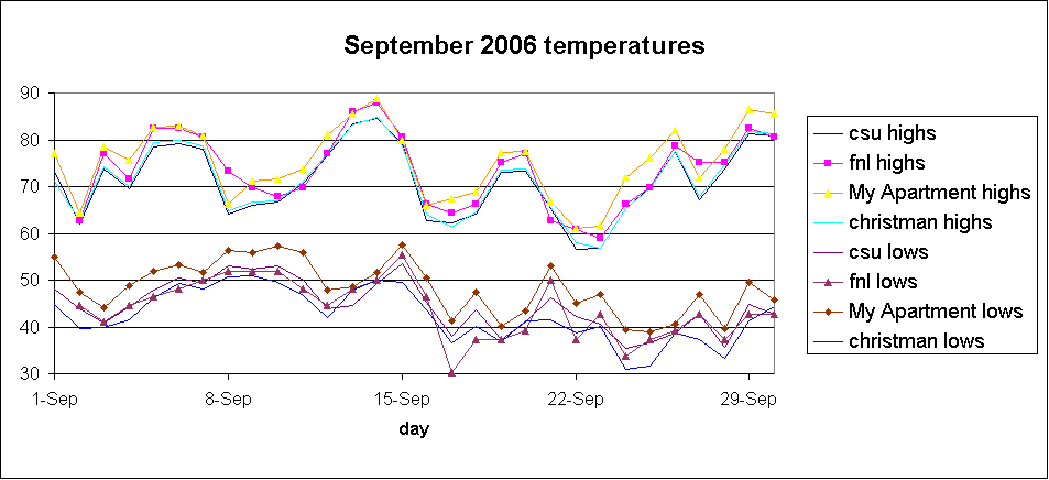
September 2006 temperatures
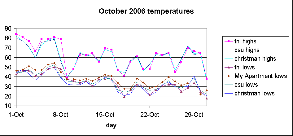
October 2006 temperatures
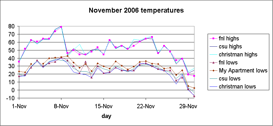
November 2006 temperatures
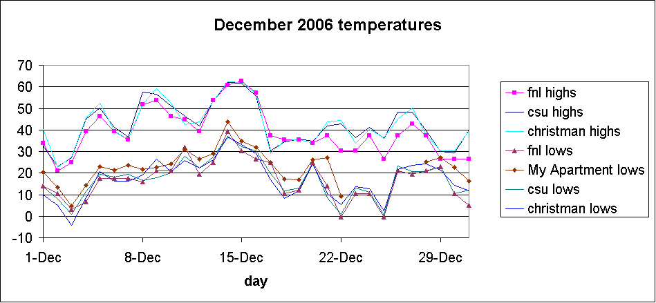
December 2006 temperatures
December 2006 major storm totals were 19.9" and 8.5"
2006 total precipitation: 11.22"
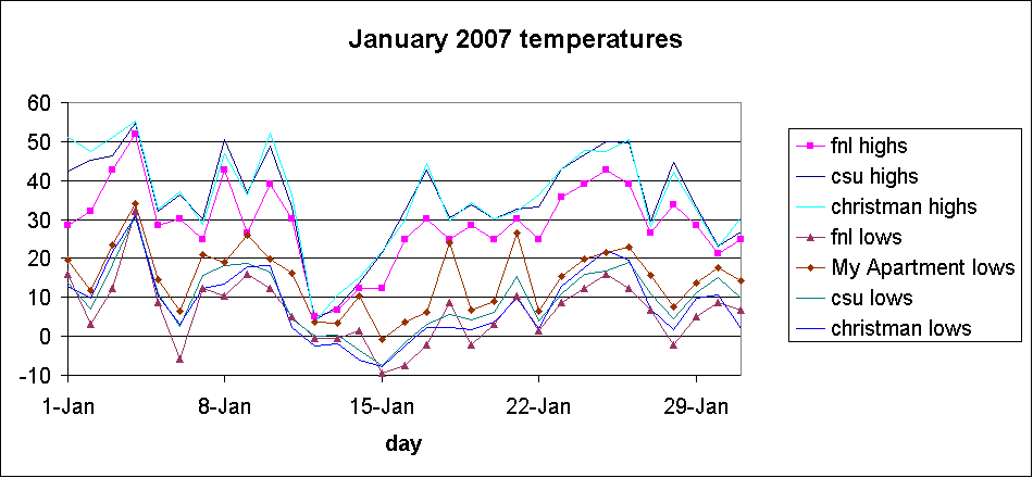
January 2007 temperatures
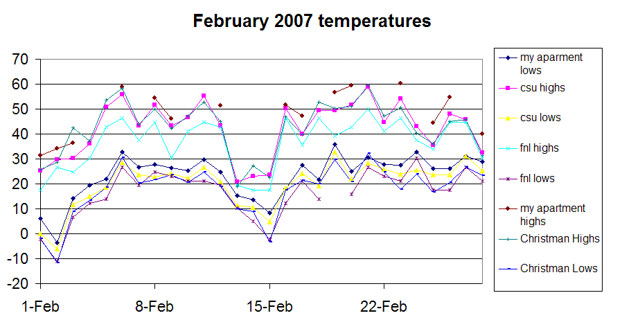
February 2007 temperatures
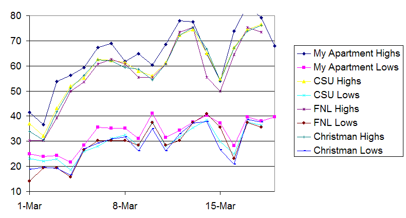
March 2007 temperatures
March 2007 temperatures-all
hours
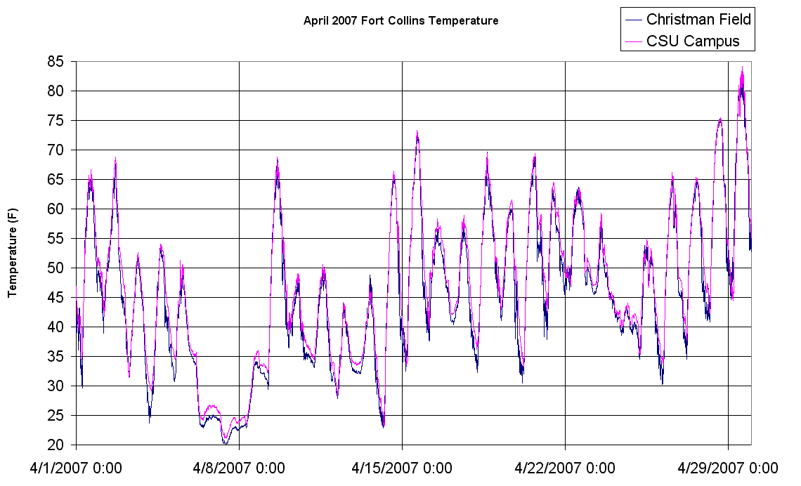
April 2007 temperatures
October 2006-April 2007 snow total: 56.5"
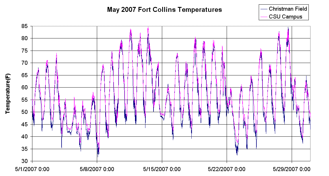
May 2007 temperatures
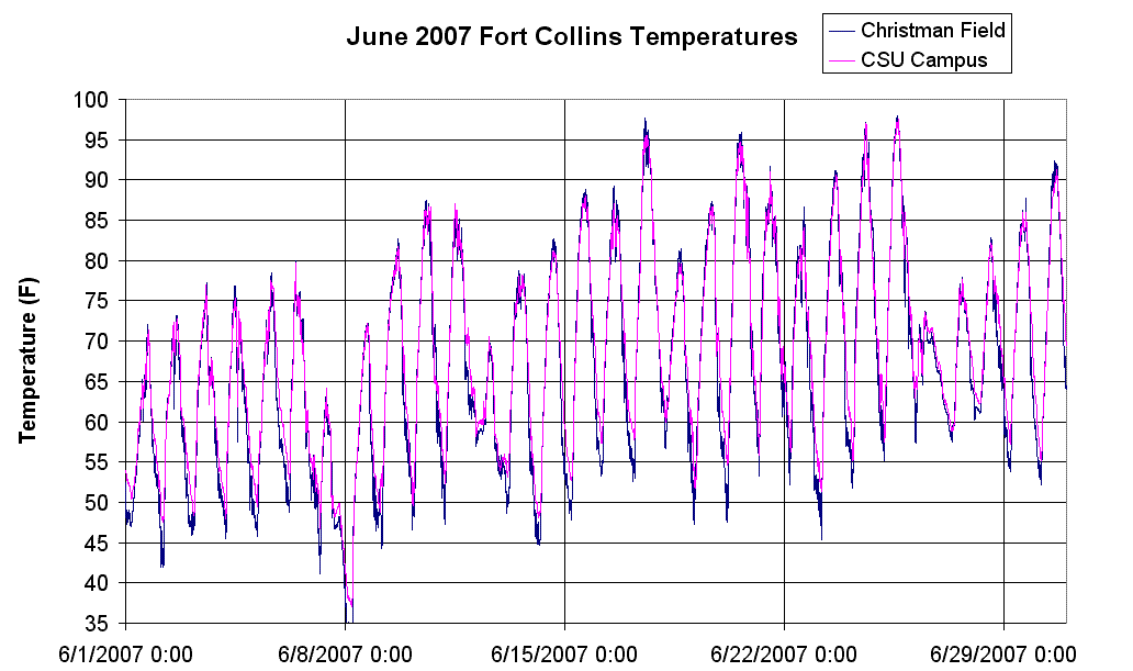
June 2007 temperatures
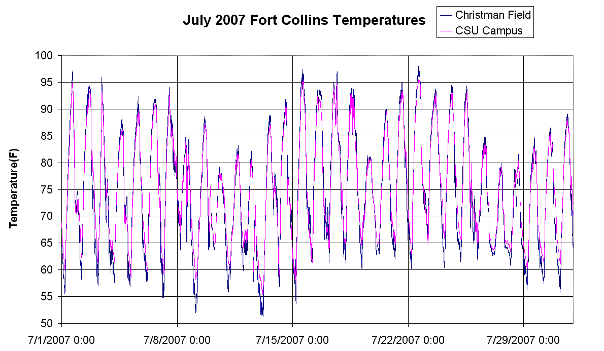
July 2007 temperatures
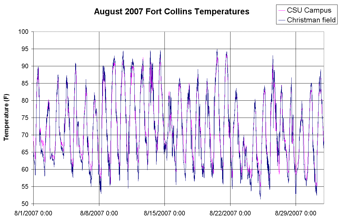
August 2007 temperatures
August 2007 precipitation: 3.6"
August 2007 Christman field precipitation: 1.16"
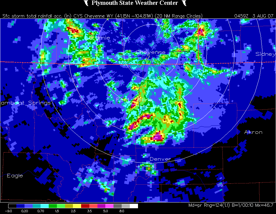
On August 2, 2007, there was 2.8" of rain at CSU.
Radar image of storm
total precipitation
This is the most
daily rainfall in parts of Fort Collins since the flood of 1997, and
August 2007 (3.6") had the most precipitation of any month in the previous 25 months,
going back to 2005.
The rainfall difference between Summer 2006 and Summer 2007
was 2.95". The 2.8" on August 2, 2007 makes up for most of this difference.
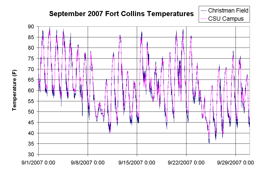
September 2007 temperatures
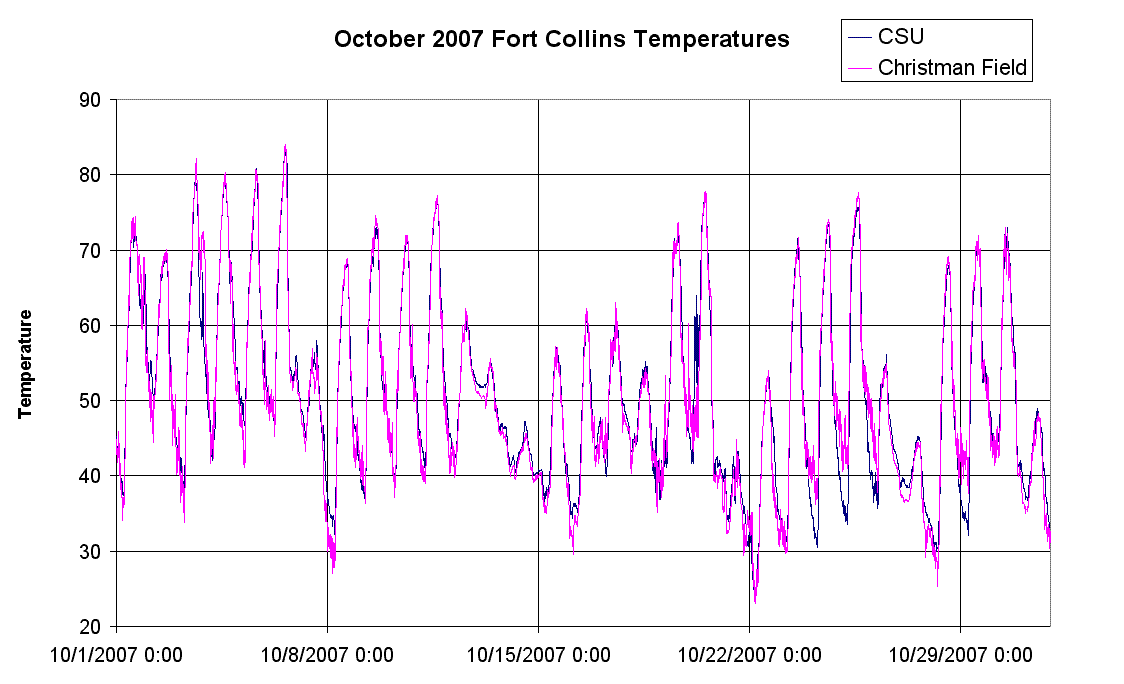
October 2007 temperatures
November 2007 temperatures
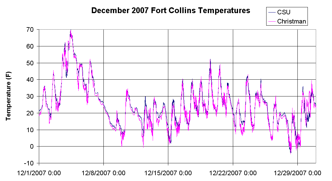
December 2007 temperatures
2007 total precipitation: 13.66"
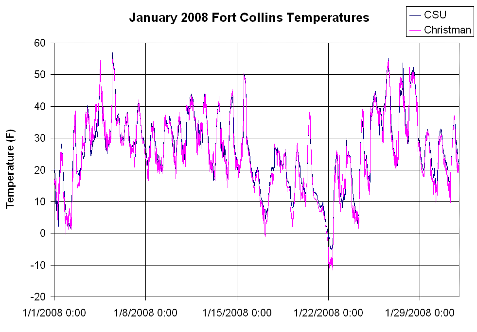
January 2008 temperatures
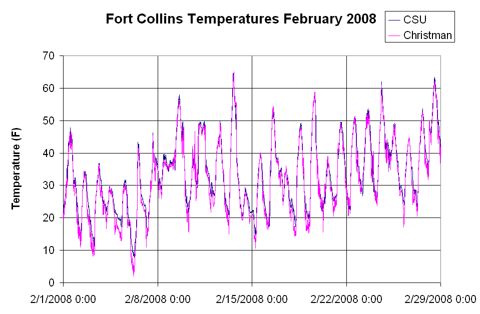
February 2008 temperatures
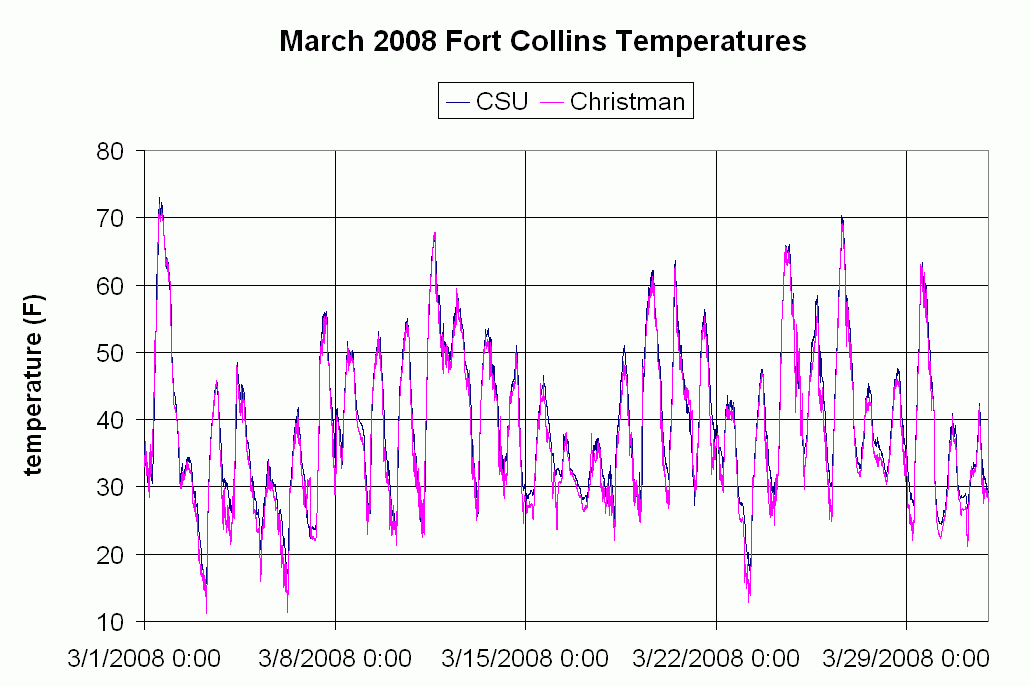
March 2008 temperatures
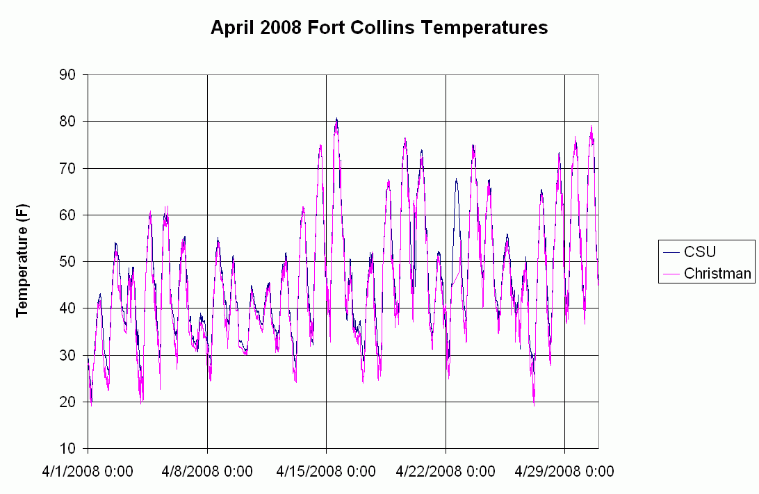
April 2008 temperatures
November 2007 to March 2008 seasonal snow total: 36.1" (possibly 36.3")
November 2007 to March 2008 precipitation total: 2.64"
November to March average precipitation: 3.53"
May 2008 temperatures
June 2008 temperatures
July 2008 temperatures
December 2008: greatest 3-day snowfall was 8.6"
2008 annual precipitation was 13.28"
The Rainy Season of 2009
May 2009
May 20th through May 31 featured 1.05" of rain and 7 days with 0.01" or more
The incredible June 2009
5.03" of rain (or melted hail) fell and 16 days with 0.01" or more
The temperature was over 2 degrees below normal
-This value of 5.03" of precipiation makes this the 6th wettest June in over 100 years of record keeping and this is 253% of normal
-There were 5 days with hail, the 7th, 10th, 11th, 15th, and 22nd
Mid-day of June 7, 2009 featured approximately 0.75" diameter hailstones and 1.07" of precipitation at Fort Collins/CSU.
Radar from June 7 2009 at 12:46PM MDT
Official Storm reports from June 7
The afternoon of June 15, 2009 featured a tornado warning, 0.74" of precipiation at Fort Collins/CSU and small hail, as well as constant nearby rumbles of thunder.
Official Storm reports from June 15
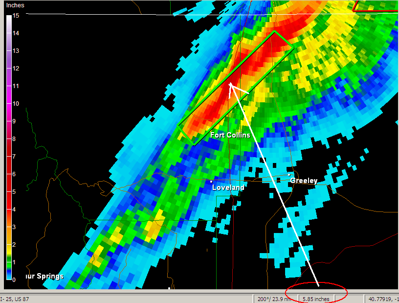
The evening of June 22, 2009 featured non-stop lightning and thunder, flooding rains and large hail (0.5" to 1.0") in north Fort Collins and Wellington. 0.83" of precipitation was recorded at Fort Collins/CSU, which did not cause much of a flash flood in the middle of town. There were two preliminary reports of tornadoes 4 miles west of Pierce (near Wellington).
Storm total precipitation from June 22, 2009 from some time between 11:00PM and 12 midnight. Note: The value of 5.8" is probably overestimated and may be in the range of 3 to 4".
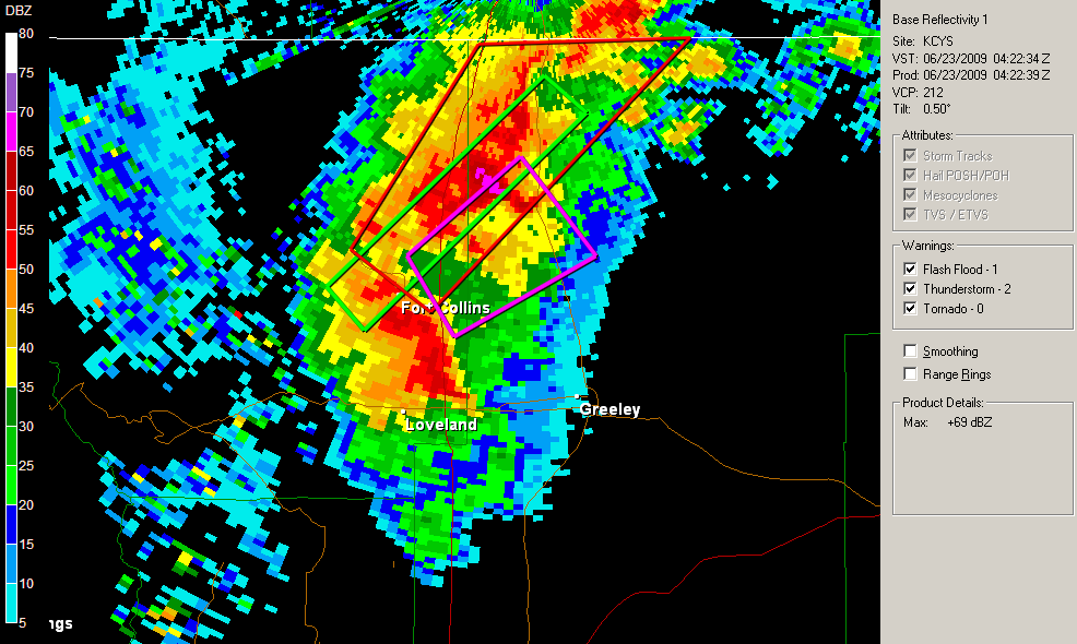
Radar from June 22, 2009 at 10:22PM MDT
Official Storm reports from June 22
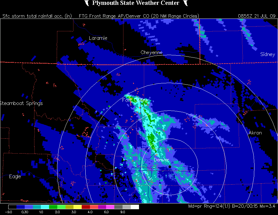
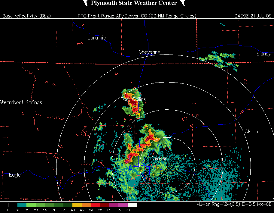
The Rainy July 2009
In July 2009, there was 3.95" of rain at Fort Collins
Hail occurred three times at the Fort Collins weather station, on the 1st, 20th, and 29th.
July 1: 0.42" and small hail at about 5:10PM
July 20: 2.10" and hail (1/2" to 1") at about 10:10PM to 11:00PM
Storm total precipiation from July 20th
July 20 radar at 10:09PM MDT
Storm Reports from July 20th
note:there was one report of 1.75" hail in Fort Collins
July 29: 0.64". about 0.31" and hail came at about 1:00AM, and lighter rain occurred at about 2:00PM
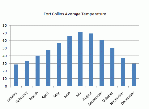
Average Temperatures
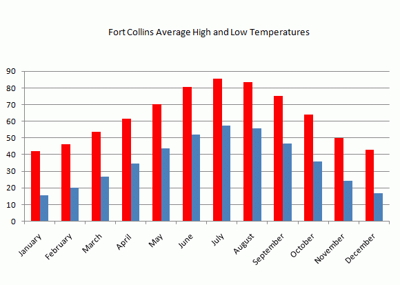
Average High/Low Temperatures
Fort Collins Monthly Climate Values

The purpose is to provide high quality information on historical storms
and provide links to weather information.